Coastal dunes are vital, yet often underappreciated, guardians of our shoreline ecosystems. These fragile landscapes serve as natural bulwarks against rising sea levels and storm surges, protecting inland communities and preserving biodiversity. Their complex structure, teeming with diverse plant species, signifies more than just scenic beauty—it embodies ecological resilience and environmental health. Despite their importance, these dunes are facing relentless threats, primarily driven by climate change and human expansion. The phenomenon of “coastal squeeze,” where rising seas encroach landward while urban development pushes inland, exemplifies the vulnerability of these ecosystems. Pollution adds another layer of harm, degrading soil quality and threatening native flora and fauna.
Innovative Technologies Transforming Dune Monitoring
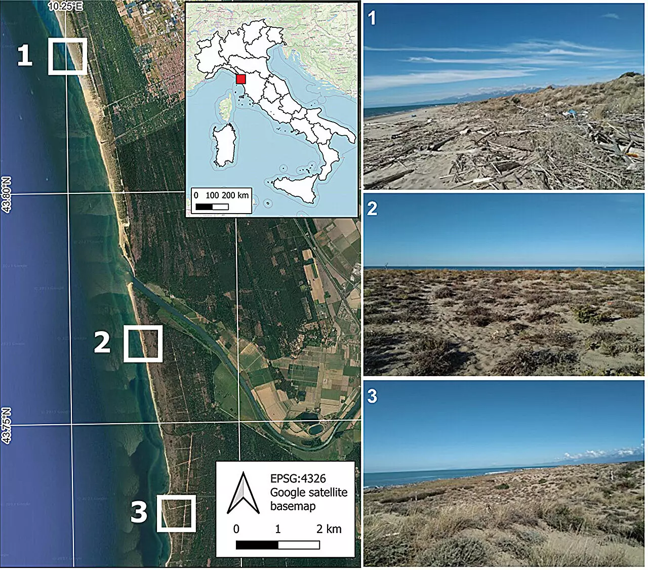
The traditional methods of mapping and monitoring coastal dunes have often been labor-intensive and limited in scope. Recognizing this gap, researchers like Melissa Latella and her team have pioneered advanced techniques leveraging cutting-edge technology. Their latest research introduces a hierarchical, multi-level classification algorithm that excels at identifying plant species at an individual level using ultra-high-resolution multispectral drone imagery. This approach signifies a paradigm shift—from broad landscape assessments to detailed, plant-by-plant analyses. Such granularity is crucial for understanding ecological dynamics and implementing targeted conservation strategies. With an accuracy rate of 76%, their method demonstrates promising reliability, paving the way for more widespread application in coastal management.
The Significance of Hierarchical Mapping for Conservation Efforts
What sets this innovative approach apart is its hierarchical framework. Instead of treating the landscape as a uniform entity, it dissects the ecosystem into nested layers—distinguishing vegetation types, then down to individual species, and even specific plants. This detailed classification aligns with the complex reality of dune ecosystems, where subtle differences dictate ecological outcomes. Moreover, the integration of machine learning techniques allows the algorithm to adapt and improve, ensuring robust performance across varying conditions. Such technological advancements offer conservationists powerful tools to monitor changes over time, detect invasive species early, and inform targeted restoration efforts. It’s a game-changer for managing these delicate ecosystems in an era where environmental pressures are intensifying.
Implications for Policy and Ecosystem Resilience
This breakthrough comes at a critical juncture. As coastal communities grapple with rising sea levels, urban sprawl, and pollution, data-driven insights are more essential than ever. High-resolution, detailed mapping equips policymakers with the concrete information needed to prioritize preservation efforts, design effective buffers, and implement sustainable urban planning. The ecological integrity of dunes directly ties into broader climate resilience, water filtration, and habitat connectivity. By pioneering this sophisticated mapping technique, Latella and her collaborators set a new standard for integrating technological innovation into environmental stewardship. It’s not just about mapping—it’s about empowering informed actions to safeguard these vital ecosystems before they are irreparably lost.
Leave a Reply