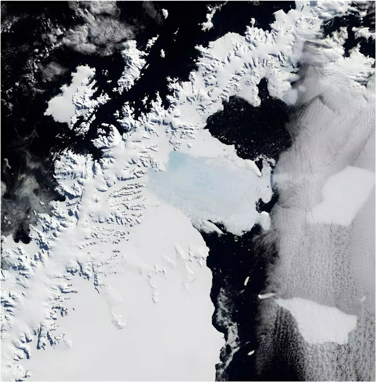
In March 2002, the world witnessed a significant environmental event—the catastrophic collapse of the Larsen B Ice Shelf, which crumbled dramatically within a week’s span. This event was not just a local disaster but one with far-reaching implications, signaling shifts that could contribute to rising global sea levels. The ice shelf, an expanse of ice one-sixth the size of Tasmania, served as a critical structure that restrained the flow of several glaciers. The collapse unleashed a torrent of ice into the ocean, a development that underscores a dire truth about climate change: what happens in the coldest reaches of our planet can have a profound impact on coastal cities and communities worldwide.
The scientific community has long understood that the stability of ice shelves and the glaciers feeding into them is crucial for predicting future sea-level rise. Despite the apparent remoteness of Antarctica, its ice dynamics are a global concern that require deep understanding and analysis of historical context. In a groundbreaking study published in *Scientific Reports*, researchers utilized nearly 1,000 film photographs from the 1960s to reconstruct the condition of five glaciers in the Larsen B region before this dramatic event. By comparing these historical records with modern assessments, scientists have begun to quantify the glaciers’ contributions to the alarming phenomenon of sea-level rise.
The Challenge of Accurate Measurements
The traditional methods of data collection in Antarctica are fraught with challenges. Many regions are so isolated that on-ground observation can be both exceedingly difficult and financially prohibitive. While satellites have offered a modern solution for monitoring these distant lands, the persistent cloud cover over regions like the Antarctic Peninsula often hampers their effectiveness, resulting in sporadic and short-term data. Such challenges heighten the significance of historical data sources, like the treasure trove of photographs captured by U.S. Navy cartographers from 1946 to 2000 that form the backbone of this research.
By utilizing advanced technologies, scientists reconstructed high-resolution, real-world scaled 3D models of glaciers using a technique called photogrammetry. Unlike traditional methods that rely on a few overlapping images, modern computing capabilities enable the amalgamation of hundreds of photos. This approach allows for the generation of detailed, three-dimensional surfaces from a cloud of millions of matching data points, making it possible to visualize changes over time accurately.
Documenting Environmental Shifts
The comparison of glacier conditions in 1968 and 2001 revealed a startling reality: prior to the Larsen B Ice Shelf collapse, the glaciers showed little change. However, the aftermath tells a different story. Following the ice shelf’s disintegration, a staggering 35 billion tons of land-based ice was lost from these glaciers, contributing approximately 0.1 mm to global sea-level rise. Though this number may seem negligible, it paints a broader picture of the increased vulnerability of glaciers in the face of climate change.
To contextualize this loss, imagine every person on Earth pouring out a one-liter bottle of water each day for ten years; this analogy serves to encapsulate the extensive contribution of just one event involving one glacier. The gravity of this situation cannot be overstated; as atmospheric and oceanic temperatures rise, the vulnerabilities of ice shelves intensify, posing significant risks to global populations.
Unlocking a Treasure Trove of Information
The historical image archive is more than just a record; it’s a vital resource that can inform future research and conservation efforts. These photographs allow scientists to extend the timeline of environmental changes, essential for developing strategies to tackle the accelerating consequences posed by climate change. Beyond the glaciers, this repository can be utilized to study other factors, including the vitality of local ecosystems, shifts in vegetation, and even the impact of human activity on fragile environments.
Moreover, the knowledge derived from these photographs is crucial as we confront an era characterized by rapid and dramatic changes to our planet’s climate. Understanding past glacial behavior offers critical insights into how these massive ice structures may react to future conditions. As scientists continue to grapple with the challenges brought about by a warming world, these historical resources become indispensable for predicting and mitigating the impacts of climate change.
The retrieval of precious information from decades-old photographs illustrates the ingenious ways in which we can confront contemporary challenges. As we navigate the complexities of climate change, understanding the historical context of key environmental elements is not just beneficial—it is essential for our future.
Leave a Reply