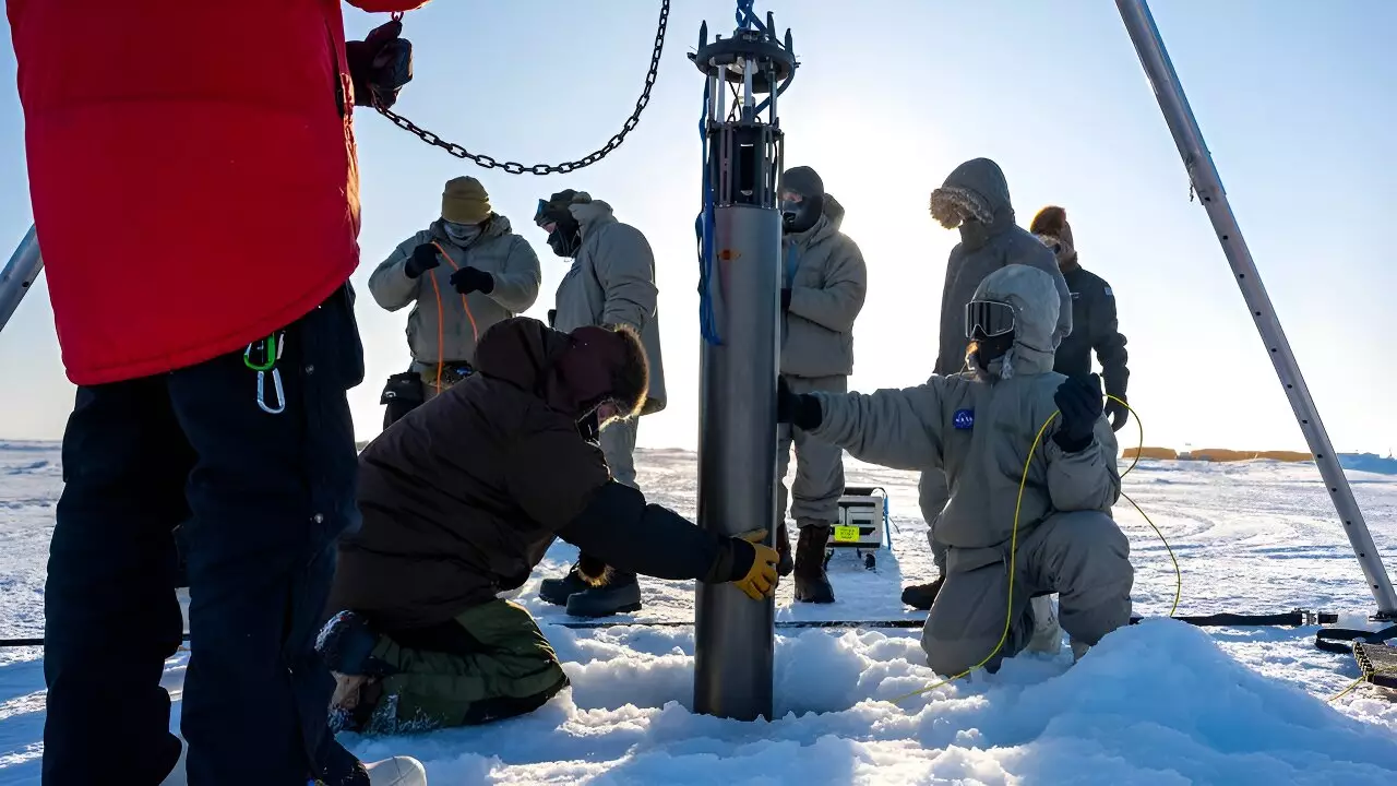
In an era where climate change remains a pressing concern, NASA’s Jet Propulsion Laboratory (JPL) is at the forefront of technological innovation designed to understand the complexities of ice melting in polar regions. Recently, a team of engineers embarked on a significant mission in the remote, icy expanses of the Beaufort Sea, situated north of Alaska. Through a narrow borehole drilled into a thick ice layer, they deployed a cylindrical robot, tasked with collecting vital data from the frigid depths below. This initiative is not merely a technological experiment; it embodies a larger aspiration known as IceNode, which aims to create a network of autonomous robots dedicated to probing the Antarctic ice shelves critical to understanding global sea level rise.
The urgency of this mission cannot be overstated. Antarctica’s massive ice sheet holds the potential to elevate global sea levels by an estimated 200 feet (60 meters) if fully melted. As such, the fate of these ice masses is both a scientific priority and an ecological necessity, with implications for coastal communities worldwide. Understanding the melting dynamics of these ice sheets, particularly in areas where they interact with warmer ocean waters, is essential for improving climate models that predict future sea level changes.
Melting occurs not solely due to atmospheric warming, but also because of the ocean’s influence. Warm ocean waters circulate beneath the ice, exacerbating the melting process along the icy underside of the shelves. Researchers are particularly focused on the so-called “grounding zone,” an intersection of land, ocean, and floating ice where crucial melting may transpire unnoticed. Unfortunately, these sites present formidable challenges to human exploration; they are often inaccessible and dangerous due to shifting ice conditions and extreme cold. Additionally, traditional satellite imagery fails to penetrate the thick ice cover, leaving significant gaps in our understanding of melting patterns.
Enter IceNode. The project’s design philosophy hinges on creating robotic systems that can autonomously navigate these hostile environments, gather crucial data, and provide a clearer understanding of ice dynamics. Ian Fenty, a climate scientist at JPL, explained the importance of getting direct measurements from the ice-ocean interface, which remains one of the most enigmatic aspects of climate science.
The robotic vehicles being developed for the IceNode program measure approximately 8 feet long and 10 inches in diameter, equipped with uniquely designed landing gear. These bots do not rely on traditional propulsion systems; instead, they are equipped with advanced software algorithms that guide them using ocean current models. The plan is for these robots to descend through boreholes or be released into the open ocean, where they will drift beneath ice shelves, collecting valuable data as they affix themselves to the underside of the ice.
As they reach their designated locations, these robots will deploy ballast to stabilize themselves and utilize their sensors to monitor temperature and salinity levels, as well as water flow. This information will be crucial for scientists gauging the rate of melting and understanding the seasonal fluctuations that occur in these remote environments.
The IceNode fleet is designed for extended operations, capable of continuously collecting data for up to a year. Once their mission is complete, the robots will detach from the ice and return to the ocean’s surface to transmit their findings via satellite, thus contributing to the global body of climate knowledge.
Though the project is still in developmental stages, initial tests have produced promising results. After successful trials in California’s Monterey Bay and Lake Superior, the team recently undertook their first polar mission, facing air temperatures plummeting to minus 50 degrees Fahrenheit (minus 45 degrees Celsius). This deployment was facilitated through the U.S. Navy Arctic Submarine Laboratory’s Ice Camp, a temporary research station that provides scientists with essential resources to conduct Arctic fieldwork.
During this test expedition, the robot descended roughly 330 feet into the ocean, gathering real-time data on water salinity, temperature, and flow rates. The engineers also assessed the necessary adjustments for future operations to improve the robots’ autonomy and efficiency.
Looking ahead, NASA’s IceNode project represents a significant leap in our ability to gather essential data from some of the planet’s most inhospitable zones. As Paul Glick, the principal investigator of the project, expressed, the robots symbolize a low-cost, safe solution to the formidable task of monitoring the Earth’s ice dynamics. The team is optimistic about continuing development and re-deploying their prototypes to deepen our understanding of how these majestic yet vulnerable ice shelves respond to a warming world.
IceNode could provide crucial insights into climate processes that shape our planet—evidence that may inform policy decisions and environmental strategies in the face of escalating climate challenges.
Leave a Reply