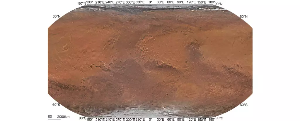
The exploration of Mars has been a topic of interest for many space agencies worldwide. In July 2020, China’s Tianwen-1 mission arrived in orbit around Mars, marking a significant milestone in interplanetary exploration. The mission consisted of six robotic elements, including an orbiter, a lander, cameras, and the Zhurong rover, with the goal of investigating Mars’s geology, atmosphere, and potential indications of water. One of the major achievements of the Tianwen-1 mission was the creation of the first high-resolution global color-image map of Mars with spatial resolutions exceeding 1 km.
Several global maps of Mars have been created using data from previous missions, such as Mariner 9, Viking 1 and 2, Mars Global Surveyor, Mars Reconnaissance Orbiter, Mars Express, and Mars Odyssey. However, these maps had spatial resolutions significantly lower than that of the Tianwen-1 map. For example, the Mars Reconnaissance Orbiter’s global mosaic had a spatial resolution of about 5 meters per pixel in the visible band, while the Viking Colorized Global Mosaic had resolutions ranging from 232 to 925 meters per pixel. The Tianwen-1 mission was able to surpass these resolutions, providing a clearer and more detailed view of the Martian surface.
Technological Advancements and Data Processing
The success of the Tianwen-1 mission in creating the high-resolution map of Mars can be attributed to advanced technology and meticulous data processing. The team led by Professor Li Chunlai and Professor Zhang Rongqiao processed data acquired by the Tianwen-1 orbiter, including images from the MoRIC instrument and the Mars Mineralogical Spectrometer. By optimizing the original orbit measurement data and using bundle adjustment technology, the team was able to reduce position deviations between images and create a seamless global mosaic. This process ultimately led to the creation of the Tianwen-1 Mars Global Color Orthomosaic 76 m V1, with a spatial resolution of 76 meters and horizontal accuracy of 68 meters.
The Tianwen-1 Mars Global Color Orthomosaic 76 m V1 is currently the highest-resolution true-color global map of Mars, providing a detailed and accurate representation of the planet’s surface. This map not only improves upon previous mapping efforts in terms of resolution and color authenticity but also serves as a valuable geographic reference for future missions to Mars. Space agencies and partner organizations can utilize this map to select landing sites for future robotic explorers and plan for crewed missions to Mars in the coming decades. The availability of such a high-resolution map will greatly contribute to our understanding of Mars and aid in the search for signs of past life on the planet.
The creation of the Tianwen-1 Mars Global Color Orthomosaic 76 m V1 represents a significant advancement in Martian surface mapping and exploration. Through the combined efforts of the CNSA and the team of researchers from the CAS, a highly detailed and accurate map of Mars has been produced, opening up new possibilities for future missions to the Red Planet. As we look ahead to the early 2030s and 2040s when crewed missions to Mars are planned, the Tianwen-1 map will serve as a crucial tool for space agencies in their continued exploration and study of our neighboring planet.


Leave a Reply