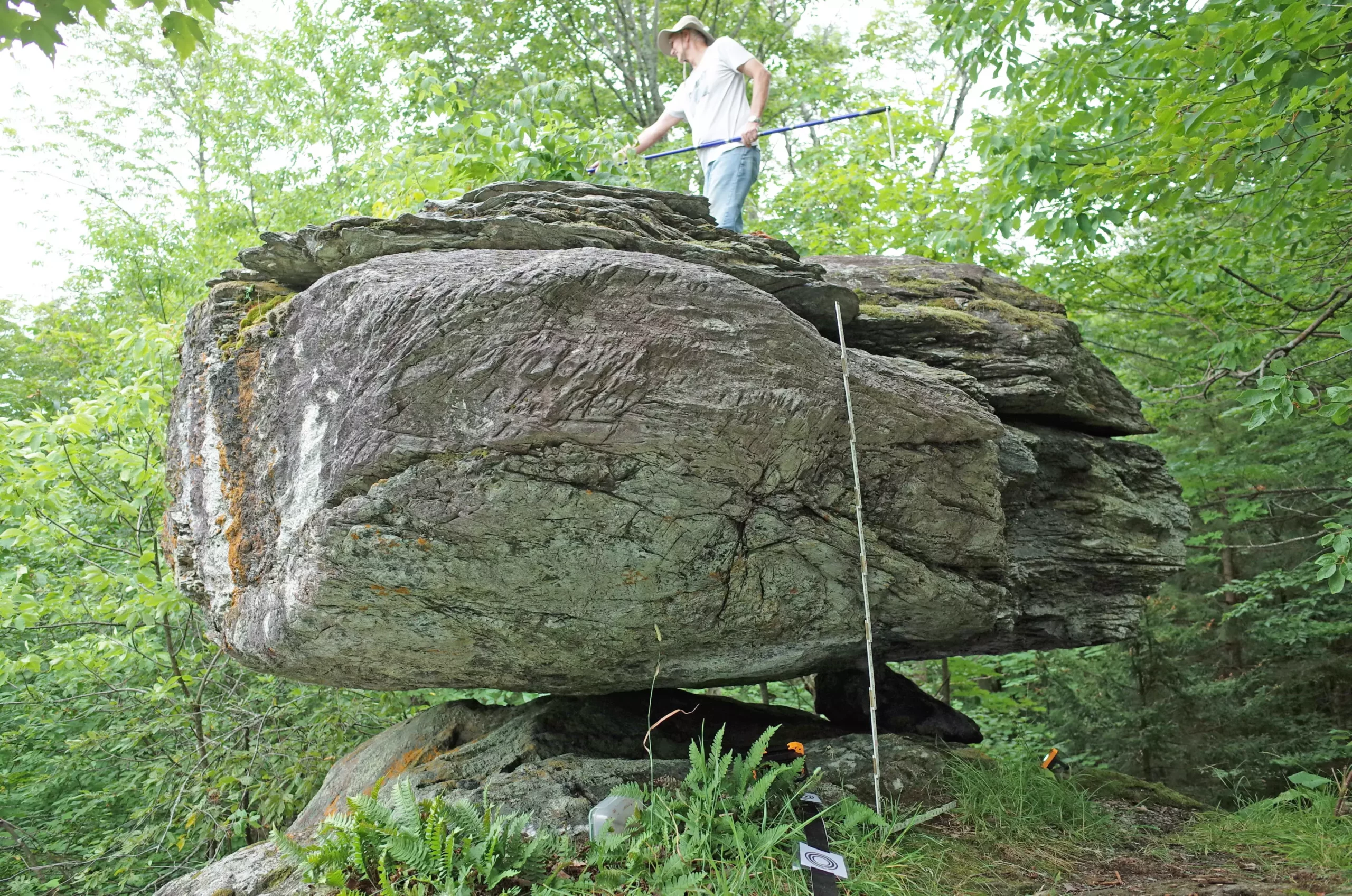
In the quest to understand seismic activity, scientists have turned their attention to an unexpected phenomenon: precariously balanced rocks (PBRs). These fascinating geological formations, primarily glacial erratics, are not just remnants of the Ice Age; they offer significant insights into the seismic hazards of northern New York and Vermont. By analyzing the stability of these boulders, researchers can infer the historical intensity of earthquakes in the region, providing valuable data for both scientists and the community.
PBRs are a unique tool for seismologists, as their precarious nature allows scientists to estimate the ground shaking intensity required to dislodge them. This assessment can unveil clues about past seismic events and potential future hazards. In a groundbreaking study published in the Bulletin of the Seismological Society of America, researchers Devin McPhillips and Thomas Pratt have expanded upon this approach by detailing five boulders scattered across northeastern U.S. states. Notably, their findings correlate closely with the predictions outlined in the U.S. Geological Survey’s 2023 National Seismic Hazard Model, confirming the reliability of this method.
Only a single boulder from their study suggested lower seismic risks for its surrounding area, implying that certain sections of the Adirondack Mountains and the Lake Champlain valley may not be vulnerable to the most powerful earthquakes.
One of the pivotal contributions of this research is the generation of maps indicating the proximity of potential earthquake sources relative to the PBRs. Such graphical representations are essential for identifying active faults and understanding the seismic landscape of the region. These maps give scientists a tool to strategically evaluate hazards, significantly benefiting regional preparedness initiatives.
Previous methods for assessing seismic hazards in the eastern United States have primarily relied on features like soil liquefaction in other seismic zones. However, this recent study marks one of the first instances of using PBRs as a framework for this purpose in northeastern states. The researchers draw parallels to other regions, particularly New Zealand and Australia, where similar methods have gained traction due to pronounced seismic risks.
The study region boasts a history intertwining natural geological movements and human fascination. The glacier movement that shaped the landscape left behind boulders weighing tons, perched delicately on pedestals carved by ice. Dating back to around 13,000 years, these formations not only signify the region’s geological past but also serve as markers of seismic activity. Despite their age, these rocks have survived major geological disturbances, leading researchers to hypothesize that, similar to PBRs studied elsewhere, they can yield significant information about historical seismic activity.
However, the challenge of locating PBRs in heavily forested and rugged terrains highlighted the necessity for collaboration with local knowledge, which facilitated the study. Enthusiasts and climbers contributed their insights, leading researchers to these remarkable formations that might otherwise remain hidden.
Employing cutting-edge technology such as ground-based lidar, the researchers assessed the fragility of the selected PBRs, which provided quantifiable data on the stability of the rocks. By establishing the contact points between these boulders and their pedestals, McPhillips and Pratt calculated the probability of toppling under varying seismic pressures. This rigorous methodology advanced the understanding of how current seismic hazards are related to geological history.
Importantly, the northern New York and Vermont regions exhibit higher seismicity than many other eastern U.S. locales, shaped by events such as the 1944 Massena and 2002 Au Sable earthquakes. The insights gained from studying PBRs not only help contextualize this seismicity but also serve as a foundation for future evaluations of earthquake risks across various landscapes.
The ongoing exploration of PBRs promises to deepen our understanding of seismic hazards. McPhillips’s enthusiasm for future discoveries in this domain underscores an emerging field that still has much potential to uncover. The knowledge gained through this research not only enhances scientific understanding but also has pragmatic implications for local communities living in earthquake-prone regions.
As we recognize the significance of geological formations, such as PBRs, in shaping our understanding of the earth, we open the door to informed responses and preparedness strategies in the face of seismic risks. The insights drawn from these remarkable boulders can prove crucial, potentially assisting in mitigating the impacts of future earthquakes in northern New York and Vermont.


Leave a Reply